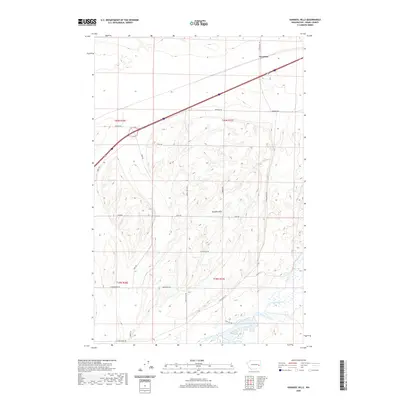
2020 Map of Karakul Hills
USGS Topo · Published 2020About this map
Keystone serves as a primary geographic anchor at the northern edge of this Adams County landscape, situated where the land transitions from the high plateaus of the north toward the distinct geological formations of the Karakul Hills. The terrain is defined by a series of north-south running ridges and coulees, typical of the Channeled Scablands. In the southern portion of the sheet, the drainage network of Cow Creek and Lugenbeal Creek converges near Cow Lake, illustrating the vital role of water in this semi-arid environment. The rectangular survey system is clearly visible through the network of section roads like Danekas Rd and E Wellsandt Rd, which trace the boundaries of Townships 19 and 20 North. This map highlights the intersection of modern transport corridors and historical agricultural patterns, with long-established property lines following the township and range grid across the undulating scabland topography.
Find a feature on this map
23 named features on this map. Tap any name to fly to it.
Don’t see what you’re looking for? This feature index may not catch every label — zoom into the map to look around manually.
Map Details
Editions of this 2020 Karakul Hills Map
This is the sole edition of this map. No revisions or reprints were ever made.
Other maps of this area

1953 · Ritzville
USGS Topo · 1:250,000

1959 · Ritzville
USGS Topo · 1:250,000

1964 · Karakul Hills
USGS Topo · 1:24,000

1964 · Macall
USGS Topo · 1:24,000

1964 · Palm Lake
USGS Topo · 1:24,000

1964 · Marengo
USGS Topo · 1:24,000

1965 · Ritzville
USGS Topo · 1:250,000

1967 · Ritzville SE
USGS Topo · 1:24,000

1967 · Ritzville NE
USGS Topo · 1:24,000

1969 · Sprague Lake
USGS Topo · 1:24,000