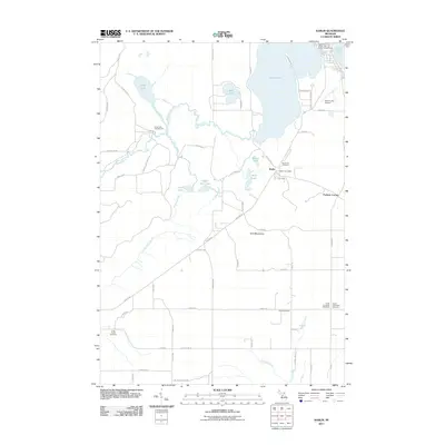
2011 Map of Karlin
USGS Topo · Published 2011About this map
Karlin serves as the primary hub of this Grand Traverse County landscape, situated near the shores of Mud Lake and Green Lake. The settlement patterns here are defined by a mix of wooded lakelands and agricultural grids, with the Karlin Post Office and local landmarks like Pavlovic Corner anchoring the community. The northern portion of the map is dominated by a chain of water bodies including Grass Lake, Bass Lake, and Duck Lake, while the southern reaches are drained by Fletcher Creek and Cotton Creek.
Find a feature on this map
63 named features on this map. Tap any name to fly to it.
Don’t see what you’re looking for? This feature index may not catch every label — zoom into the map to look around manually.
Map Details
Editions of this 2011 Karlin Map
This is the sole edition of this map. No revisions or reprints were ever made.
Other maps of this area

1954 · Traverse City
USGS Topo · 1:250,000

1956 · Kingsley
USGS Topo · 1:62,500

1956 · Mesick
USGS Topo · 1:62,500

1956 · Thompsonville
USGS Topo · 1:62,500

1957 · Copemish
USGS Topo · 1:62,500

1958 · Traverse City
USGS Topo · 1:250,000

1976 · Thompsonville NE
USGS Topo · 1:24,000
1976 · Thompsonville SW
USGS Topo · 1:24,000

1976 · Thompsonville NW
USGS Topo · 1:24,000

1976 · Thompsonville SE
USGS Topo · 1:24,000
Featured Places
- Green Lake Township, MI
- Grant Township, MI
- Cleon Township, MI
- Inland Township, MI
- Pavlovic Corner, Grant Township