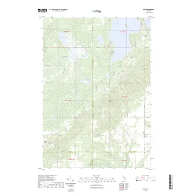
2023 Map of Karlin
USGS Topo · Published 2023About this map
Green Lake and the Betsie River drainage define the geography of this northern Michigan landscape, where the borders of Grand Traverse, Benzie, Manistee, and Wexford counties converge. The small settlement of Karlin sits near the eastern shore of Round Lake, while Nessen City anchors the southwestern portion of the sheet. The area is notable for its numerous cemeteries, including De Lorme Cem and the Grant Methodist Cem, which offer significant research value for local genealogists.
Find a feature on this map
82 named features on this map. Tap any name to fly to it.
Don’t see what you’re looking for? This feature index may not catch every label — zoom into the map to look around manually.
Map Details
Editions of this 2023 Karlin Map
This is the sole edition of this map. No revisions or reprints were ever made.
Other maps of this area

1954 · Traverse City
USGS Topo · 1:250,000

1956 · Kingsley
USGS Topo · 1:62,500

1956 · Mesick
USGS Topo · 1:62,500

1956 · Thompsonville
USGS Topo · 1:62,500

1957 · Copemish
USGS Topo · 1:62,500

1958 · Traverse City
USGS Topo · 1:250,000

1976 · Thompsonville NE
USGS Topo · 1:24,000
1976 · Thompsonville SW
USGS Topo · 1:24,000

1976 · Thompsonville NW
USGS Topo · 1:24,000

1976 · Thompsonville SE
USGS Topo · 1:24,000