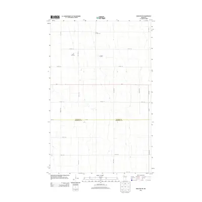
2013 Map of Karlstad SW
USGS Topo · Published 2013About this map
Kittson and Marshall counties meet along the high plains of northwest Minnesota in this 2013 survey. The landscape is defined by a strictly organized grid of township roads and section lines, reflecting the enduring legacy of the Public Land Survey System in this agricultural region. Small, private family plots and community graveyards such as Pederson Burials, Edward Johnson Cem, and Oslo Lutheran Cem serve as quiet landmarks among the expansive fields. Transport across this corner of the state is anchored by Mn-11, which cuts a straight line east-to-west, and Csah 18, marking the boundary between the two counties. This map captures the rural infrastructure of the early 21st century, where numbered roads like Co Hwy 1 and 270th Ave NW connect isolated farmsteads and historic family holdings.
Find a feature on this map
23 named features on this map. Tap any name to fly to it.
Don’t see what you’re looking for? This feature index may not catch every label — zoom into the map to look around manually.
Map Details
Editions of this 2013 Karlstad SW Map
This is the sole edition of this map. No revisions or reprints were ever made.
Other maps of this area

1918 · Argyle
USGS Topo · 1:62,500

1939 · Kennedy
USGS Topo · 1:62,500

1941 · Kennedy
USGS Topo · 1:62,500

1952 · Thief River Falls
USGS Topo · 1:250,000

1954 · Stephen
USGS Topo · 1:62,500

1956 · Thief River Falls
USGS Topo · 1:250,000

1956 · Karlstad
USGS Topo · 1:62,500

1956 · Florian
USGS Topo · 1:62,500

1957 · Thief River Falls
USGS Topo · 1:250,000

1967 · Thief River Falls
USGS Topo · 1:250,000