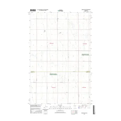
2016 Map of Karlstad SW
USGS Topo · Published 2016About this map
Agricultural lands and isolated burial grounds define this section of the Red River Valley along the border of Kittson Co and Marshall Co. The landscape is etched with a strictly linear road network, including north-south corridors like 340th Ave and Co Hwy 150. Family history and local heritage are preserved in scattered sites such as the Oslo Lutheran Cem and Edward Johnson Cem, alongside the specifically identified Pederson Burials. These small, localized cemeteries amidst large-scale farming tracts suggest the enduring presence of early homesteading families in this prairie region. Significant portions of the township are designated as Farm Service Agency Interest of Minnesota, reflecting contemporary land management and conservation practices within the intensive agricultural environment of Northwest Minnesota.
Find a feature on this map
27 named features on this map. Tap any name to fly to it.
Don’t see what you’re looking for? This feature index may not catch every label — zoom into the map to look around manually.
Map Details
Editions of this 2016 Karlstad SW Map
This is the sole edition of this map. No revisions or reprints were ever made.
Other maps of this area

1918 · Argyle
USGS Topo · 1:62,500

1939 · Kennedy
USGS Topo · 1:62,500

1941 · Kennedy
USGS Topo · 1:62,500

1952 · Thief River Falls
USGS Topo · 1:250,000

1954 · Stephen
USGS Topo · 1:62,500

1956 · Thief River Falls
USGS Topo · 1:250,000

1956 · Karlstad
USGS Topo · 1:62,500

1956 · Florian
USGS Topo · 1:62,500

1957 · Thief River Falls
USGS Topo · 1:250,000

1967 · Thief River Falls
USGS Topo · 1:250,000