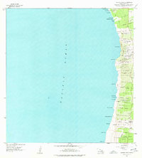
1962 Map of Kauluoa Point
USGS Topo · Published 1977About this map
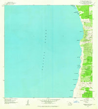
The coastal landscape of South Kona, as captured in this 1962 field study, is defined by the stark intersection of volcanic activity and human settlement. The map traces the devastating path of the Honokua Lava Flow of 1950 and the Pahoehoe 2 Lava Flow of 1950 as they reached the Pacific Ocean south of Kauluoa Pt. Inland, the agricultural and residential organization of the island is visible through the clustered Olelomoana Homesteads, Haukalua 2 Homesteads, and Alae 1-2 Homesteads. These rural land divisions, supported by the Alae Sch, represent the local community structure along the western slopes of the island. Evidence of traditional land use and climate adaptation appears through numerous Rain Shed labels and a notable Rock Wall near Honokua, while the South Kona Forest Reserve anchors the higher elevations to the south.
Find a feature on this map
54 named features on this map. Tap any name to fly to it.
Don’t see what you’re looking for? This feature index may not catch every label — zoom into the map to look around manually.
Map Details
Editions of this 1962 Kauluoa Point Map
2 editions found
Other maps of this area

1928 · Hoopuloa
USGS Topo · 1:62,500

1954 · Hawaii South
USGS Topo · 1:250,000

1959 · Hawaii South
USGS Topo · 1:250,000

1959 · Honaunau
USGS Topo · 1:24,000
1960 · Kaunene
USGS Topo · 1:24,000

1961 · Hawaii South
USGS Topo · 1:250,000

1962 · Hawaii South
USGS Topo · 1:250,000

1962 · Milolii
USGS Topo · 1:24,000

1962 · Papa
USGS Topo · 1:24,000
1962 · Kauluoa Point
USGS Topo · 1:24,000