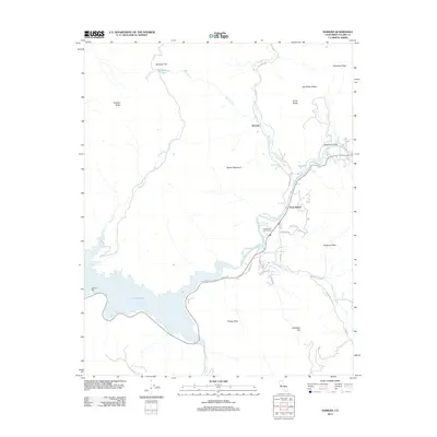
2012 Map of Kaweah
USGS Topo · Published 2012About this map
Three Rivers serves as the focal point of this 2012 survey, situated where the N Fork Kaweah River and S Fork Kaweah River converge. The landscape is defined by the massive footprint of Lake Kaweah, which dominates the southwestern quadrant and collects the flow of Greasy Cr and Horse Cr. This modern map illustrates the contemporary residential layout of the foothills, specifically around Washburn Cove and along roads like Sunset Dr and Quail Run Dr. Beyond the primary settlements, the topography rises sharply into high ridges and peaks, including Barton Mountain, Blossom Peak, and Tharps Peak. The presence of Mankins Flat and Cherokee Flat indicates historical mountain plateaus that remain named features today, while the Three Rivers Golf Course highlights the recreational development within the river valley.
Find a feature on this map
35 named features on this map. Tap any name to fly to it.
Don’t see what you’re looking for? This feature index may not catch every label — zoom into the map to look around manually.
Map Details
Editions of this 2012 Kaweah Map
This is the sole edition of this map. No revisions or reprints were ever made.
Other maps of this area

1903 · Tehipite
USGS Topo · 1:125,000

1904 · Kaweah
USGS Topo · 1:125,000

1905 · Tehipite
USGS Topo · 1:125,000

1909 · Kaweah
USGS Topo · 1:125,000

1922 · Trimmer
USGS Topo · 1:96,000

1924 · Dinuba
USGS Topo · 1:125,000

1925 · Rocky Hill
USGS Topo · 1:31,680

1927 · Rocky Hill
USGS Topo · 1:31,680

1928 · Lemon Cove
USGS Topo · 1:31,680

1937 · Kaweah
USGS Topo · 1:125,000