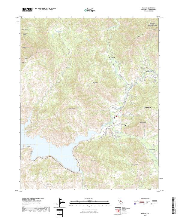
2021 Map of Kaweah
USGS Topo · Published 2021About this map
Lake Kaweah dominates the southwestern corner of this survey, where the waters of the Kaweah River are impounded before flowing toward the valley floor. The settlement of Three Rivers sits at the confluence of several forks, including the N Fork Kaweah River and the S Fork Kaweah River, serving as a gateway to the high peaks of the Sierra Nevada. To the northeast, the boundary of Sequoia National Park cuts across the ridgeline near Shepherd Peak, marking a transition into protected wilderness.
Find a feature on this map
59 named features on this map. Tap any name to fly to it.
Don’t see what you’re looking for? This feature index may not catch every label — zoom into the map to look around manually.
Map Details
Editions of this 2021 Kaweah Map
This is the sole edition of this map. No revisions or reprints were ever made.
Other maps of this area

1903 · Tehipite
USGS Topo · 1:125,000

1904 · Kaweah
USGS Topo · 1:125,000

1905 · Tehipite
USGS Topo · 1:125,000

1909 · Kaweah
USGS Topo · 1:125,000

1922 · Trimmer
USGS Topo · 1:96,000

1924 · Dinuba
USGS Topo · 1:125,000

1925 · Rocky Hill
USGS Topo · 1:31,680

1927 · Rocky Hill
USGS Topo · 1:31,680

1928 · Lemon Cove
USGS Topo · 1:31,680

1937 · Kaweah
USGS Topo · 1:125,000