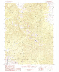
1987 Map of Kawich Peak
USGS Topo · Published 1988About this map
The high desert terrain of the Kawich Range defines this mid-1980s topographical study, where the peaks of Kawich Peak and Nixon Peak tower over a landscape marked by extensive mineral exploration. At the settlement of Silverbow, the map records evidence of human habitation and enterprise through a lonely Grave and a dense concentration of mining infrastructure. This activity is particularly concentrated in the southern portion of the range, where dozens of Prospect sites, Adit openings, and Mine Shaft locations are meticulously charted.
Find a feature on this map
19 named features on this map. Tap any name to fly to it.
Don’t see what you’re looking for? This feature index may not catch every label — zoom into the map to look around manually.
Map Details
Editions of this 1987 Kawich Peak Map
This is the sole edition of this map. No revisions or reprints were ever made.
Other maps of this area

1908 · Kawich
USGS Topo · 1:250,000

1942 · Cactus Range
USGS Topo · 1:125,000

1942 · Reveille Peak
USGS Topo · 1:125,000

1952 · Stinking Spring
USGS Topo · 1:62,500

1952 · Kawich Peak
USGS Topo · 1:62,500

1954 · Goldfield
USGS Topo · 1:250,000

1955 · Goldfield
USGS Topo · 1:250,000

1956 · Tonopah
USGS Topo · 1:250,000

1958 · Goldfield
USGS Topo · 1:250,000

1959 · Tonopah
USGS Topo · 1:250,000