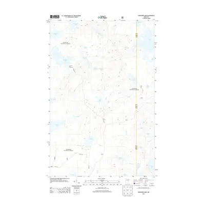
2013 Map of Kawishiwi Lake
USGS Topo · Published 2013About this map
Superior National Forest defines this lake-studded landscape on the border of Cook and Lake Counties. This 2013 survey documents a remote wilderness character shaped by a dense network of glacial water bodies, from the larger Kawishiwi Lake and Perent Lake to the more isolated Phoebe Lake and Kawasachong Lake. Access is limited to a few primitive routes such as Forest Rte 354 and Lake 29 Rd, which lead toward the Kawishiwi Lake Campground. The map illustrates a complex drainage system where Hog Cr, Bill Cr, and Coffee Cr weave between ridges to connect these high-latitude basins. This environment remains a preserve of Northwoods hydrology, providing a detailed record of the waterways and forest service infrastructure in the years following the turn of the century.
Find a feature on this map
37 named features on this map. Tap any name to fly to it.
Don’t see what you’re looking for? This feature index may not catch every label — zoom into the map to look around manually.
Map Details
Editions of this 2013 Kawishiwi Lake Map
This is the sole edition of this map. No revisions or reprints were ever made.
Other maps of this area

1954 · Two Harbors
USGS Topo · 1:250,000

1955 · Tofte
USGS Topo · 1:62,500

1955 · Cramer
USGS Topo · 1:62,500

1957 · Two Harbors
USGS Topo · 1:250,000

1958 · Two Harbors
USGS Topo · 1:250,000

1960 · Lake Polly
USGS Topo · 1:24,000

1960 · Kawishiwi Lake
USGS Topo · 1:24,000

1960 · Perent Lake
USGS Topo · 1:24,000

1960 · Beth Lake
USGS Topo · 1:24,000
1960 · Kelso Mountain
USGS Topo · 1:24,000