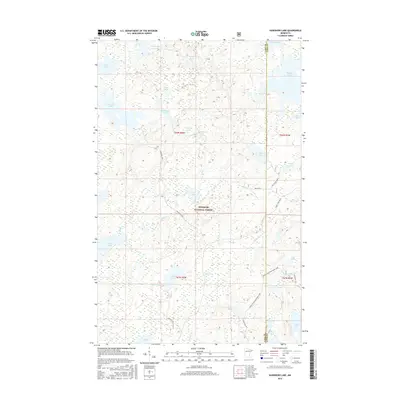
2016 Map of Kawishiwi Lake
USGS Topo · Published 2016About this map
Superior National Forest encompasses this aquatic landscape, where a dense network of lakes and drainage systems defines the terrain at the boundary of Cook and Lake Counties. The northern half is dominated by significant water bodies such as Kawishiwi Lake, Kawasachong Lake, and Phoebe Lake, connected by minor waterways like Hog Creek and Bill Creek. Navigation through this wooded interior is facilitated by narrow corridors like Perent Lake Road and Hog Creek Spur A, which provide access to the more isolated southern reaches near Perent Lake. The hydrography reflects a complex glacial legacy, evidenced by the proximity of Cross River/Wringer Lake and Whitefish Lake near the eastern boundary, showing how the regional drainage patterns were established well before modern forestry management.
Find a feature on this map
43 named features on this map. Tap any name to fly to it.
Don’t see what you’re looking for? This feature index may not catch every label — zoom into the map to look around manually.
Map Details
Editions of this 2016 Kawishiwi Lake Map
This is the sole edition of this map. No revisions or reprints were ever made.
Other maps of this area

1954 · Two Harbors
USGS Topo · 1:250,000

1955 · Tofte
USGS Topo · 1:62,500

1955 · Cramer
USGS Topo · 1:62,500

1957 · Two Harbors
USGS Topo · 1:250,000

1958 · Two Harbors
USGS Topo · 1:250,000

1960 · Lake Polly
USGS Topo · 1:24,000

1960 · Kawishiwi Lake
USGS Topo · 1:24,000

1960 · Perent Lake
USGS Topo · 1:24,000

1960 · Beth Lake
USGS Topo · 1:24,000
1960 · Kelso Mountain
USGS Topo · 1:24,000