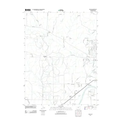
2012 Map of Keats
USGS Topo · Published 2012About this map
The Kansas River and its varied northern tributaries shape the landscape west of Manhattan, Kansas, where agricultural research and residential growth converge. The rural settlement of Keats stands north of the winding Wildcat Cr, while the southern portion of the map is dominated by the Manhattan Regional Airport and institutional grounds. These include the Kansas State Horticulture Farm, the Ashland Agronomy Farm, and the Rebekah IOOF Home.
Find a feature on this map
86 named features on this map. Tap any name to fly to it.
Don’t see what you’re looking for? This feature index may not catch every label — zoom into the map to look around manually.
Map Details
Editions of this 2012 Keats Map
This is the sole edition of this map. No revisions or reprints were ever made.
Other maps of this area

1886 · Junction City
USGS Topo · 1:125,000

1889 · Junction City
USGS Topo · 1:125,000

1894 · Junction City
USGS Topo · 1:125,000

1947 · Manhattan
USGS Topo · 1:62,500

1947 · Fort Riley
USGS Topo · 1:62,500

1950 · Keats
USGS Topo · 1:24,000

1950 · Manhattan
USGS Topo · 1:24,000

1950 · Junction City
USGS Topo · 1:24,000

1951 · Swede Creek
USGS Topo · 1:24,000

1951 · Ogden
USGS Topo · 1:24,000