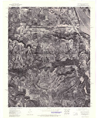
1972 Map of Keefeton SE
USGS Topo · Published 1974About this map
Webbers Falls Reservoir dominates the northeastern corner of this 1972 orthophotomosaic, marking the significant impact of mid-century water management on the Muskogee County landscape. The aerial photography reveals the intricate interface between the reservoir's fingers and the surrounding terrain, providing a stark visual record of the shoreline as it existed in the early 1970s. Further inland, the settlement of Keefeton sits along a primary corridor, surrounded by a patchwork of agricultural fields and wooded sections. To the south, the topography shifts noticeably toward the Rattlesnake Mountains, where the darker textures of dense vegetation and elevation changes are captured in detail. This photographic survey is particularly valuable for understanding local land use and property boundaries before later decades of development modified the rural character of the area.
Find a feature on this map
3 named features on this map. Tap any name to fly to it.
Don’t see what you’re looking for? This feature index may not catch every label — zoom into the map to look around manually.
Map Details
Editions of this 1972 Keefeton SE Map
This is the sole edition of this map. No revisions or reprints were ever made.
Other maps of this area

1900 · Sansbois
USGS Topo · 1:125,000

1901 · Muscogee
USGS Topo · 1:125,000

1905 · Muscogee
USGS Topo · 1:125,000

1909 · Sans Bois
USGS Topo · 1:125,000

1911 · Sansbois
USGS Topo · 1:125,000

1946 · Fort Smith
USGS Topo · 1:250,000

1948 · Keefeton
USGS Topo · 1:62,500

1948 · Webbers Falls
USGS Topo · 1:62,500

1950 · Keefeton
USGS Topo · 1:62,500

1950 · Webbers Falls
USGS Topo · 1:62,500