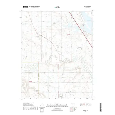
2018 Map of Keefton
USGS Topo · Published 2018About this map
Warner anchors the southern edge of this landscape, situated just below the elevations of Warner Mtn and the Rattlesnake Mountains. The region is defined by the winding course of Dirty Creek and Spaniard Creek, which drain toward the northeast into Webbers Falls Reservoir. This 2018 survey reveals a rural infrastructure of agricultural roads and scattered settlements, including Keefton, Martin, and McLain. For those researching local family history, several burial grounds are preserved across the quadrangle, such as Warner Memorial Cem, Rock Grove Cem, and Agnew Cem. The Muskogee Tpke cuts a diagonal path through the northeastern corner, illustrating the modern transportation corridor that bypasses the smaller communities of earlier eras. The boundary between McIntosh and Muskogee Counties is also clearly delineated, showing the administrative divide in this part of Oklahoma.
Find a feature on this map
37 named features on this map. Tap any name to fly to it.
Don’t see what you’re looking for? This feature index may not catch every label — zoom into the map to look around manually.
Map Details
Editions of this 2018 Keefton Map
This is the sole edition of this map. No revisions or reprints were ever made.
Other maps of this area

1900 · Sansbois
USGS Topo · 1:125,000

1901 · Muscogee
USGS Topo · 1:125,000

1905 · Muscogee
USGS Topo · 1:125,000

1909 · Sans Bois
USGS Topo · 1:125,000

1911 · Sansbois
USGS Topo · 1:125,000

1946 · Fort Smith
USGS Topo · 1:250,000

1948 · Keefeton
USGS Topo · 1:62,500

1948 · Webbers Falls
USGS Topo · 1:62,500

1950 · Keefeton
USGS Topo · 1:62,500

1950 · Webbers Falls
USGS Topo · 1:62,500