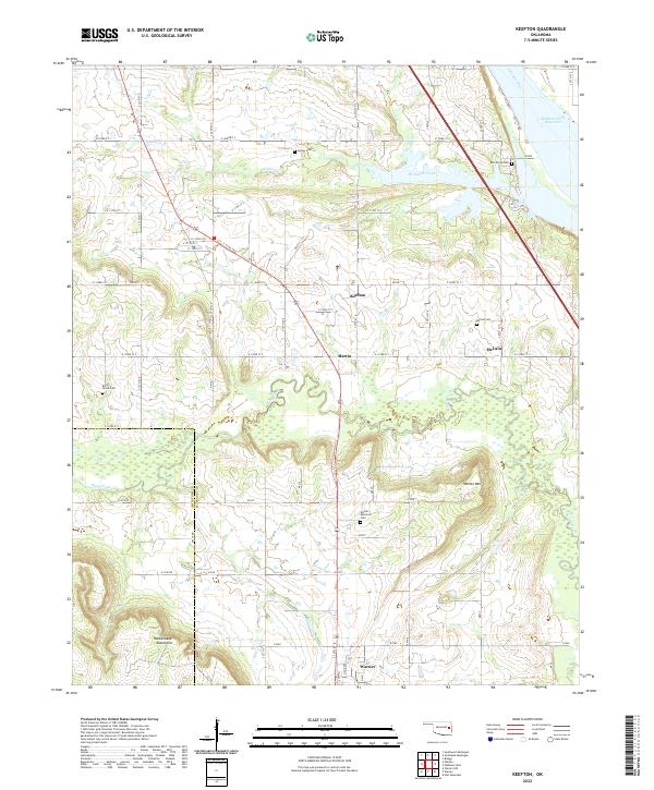
2022 Map of Keefton
USGS Topo · Published 2022About this map
Keefton and the surrounding rural communities of McLain and Martin characterize this portion of Muskogee County in the early 21st century. The landscape is defined by the transition from the rolling elevations of the Rattlesnake Mountains and Warner Mtn down toward the southern banks of the Arkansas River. Significant local history is preserved in a network of family and community burial grounds, including Agnew Cem, Elm Grove Cem, and Rock Grove Cem, which remain scattered across the sections. The eastern edge of the quadrangle is dominated by the waters of the Webbers Falls Reservoir, while a grid of county roads such as E 1030 Rd and E 133rd St S provides access to the dispersed homesteads and farms. The boundary between McIntosh and Muskogee counties cuts through the southwestern corner, following the course of Dirty Creek.
Find a feature on this map
36 named features on this map. Tap any name to fly to it.
Don’t see what you’re looking for? This feature index may not catch every label — zoom into the map to look around manually.
Map Details
Editions of this 2022 Keefton Map
This is the sole edition of this map. No revisions or reprints were ever made.
Other maps of this area

1900 · Sansbois
USGS Topo · 1:125,000

1901 · Muscogee
USGS Topo · 1:125,000

1905 · Muscogee
USGS Topo · 1:125,000

1909 · Sans Bois
USGS Topo · 1:125,000

1911 · Sansbois
USGS Topo · 1:125,000

1946 · Fort Smith
USGS Topo · 1:250,000

1948 · Keefeton
USGS Topo · 1:62,500

1948 · Webbers Falls
USGS Topo · 1:62,500

1950 · Keefeton
USGS Topo · 1:62,500

1950 · Webbers Falls
USGS Topo · 1:62,500