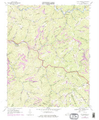
1968 Map of Keen Mountain
USGS Topo · Published 1978About this map
The extractive industrial landscape of the Buchanan Co coalfields is documented here in the late 1960s, showing a terrain defined by extensive Strip Mine operations. The Norfolk and Western railway follows the winding path of the Levisa Fork, serving the coal tipples and mines that anchor local communities like Keen Mountain and Grimsleyville. This period of development shows the tight relationship between the region's steep topography and its mining economy, with settlements and roads clustered in narrow gaps such as Shortt Gap and Bill Young Gap.
Find a feature on this map
86 named features on this map. Tap any name to fly to it.
Don’t see what you’re looking for? This feature index may not catch every label — zoom into the map to look around manually.
Map Details
Editions of this 1968 Keen Mountain Map
3 editions found
Other maps of this area

1886 · Grundy
USGS Topo · 1:125,000

1890 · Grundy
USGS Topo · 1:125,000

1891 · Tazewell
USGS Topo · 1:125,000

1892 · Grundy
USGS Topo · 1:125,000

1895 · Tazewell
USGS Topo · 1:125,000

1897 · Tazewell
USGS Topo · 1:125,000

1910 · Iaeger
USGS Topo · 1:48,000

1912 · Iaeger
USGS Topo · 1:62,500

1914 · Bucu
USGS Topo · 1:48,000

1914 · Iaeger
USGS Topo · 1:48,000