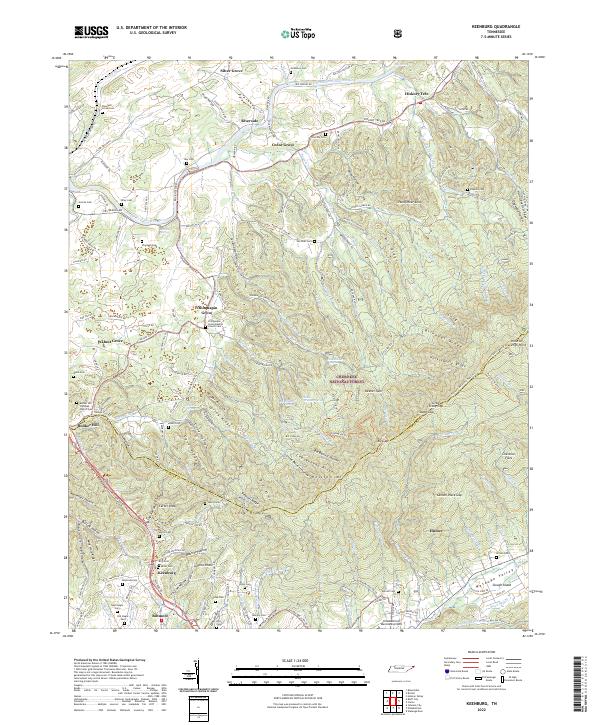
2022 Map of Keenburg
USGS Topo · Published 2022About this map
The South Fork Holston River winds through the northern portion of this map, anchoring a landscape of small settlements and mountain ridges along the Sullivan Co and Carter Co border. Communities such as Silver Grove, Cedar Grove, and Hickory Tree define the river valley, while the southern terrain is dominated by the dense elevations of the Cherokee National Forest. Higher peaks like Holston High Point and Grandfather Knob overlook a network of narrow valleys and family-named hollows, including Bauxite Hollow, which hints at the region's geological and mineral interests.
Find a feature on this map
199 named features on this map. Tap any name to fly to it.
Don’t see what you’re looking for? This feature index may not catch every label — zoom into the map to look around manually.
Map Details
Editions of this 2022 Keenburg Map
This is the sole edition of this map. No revisions or reprints were ever made.
Other maps of this area

1891 · Roan Mountain
USGS Topo · 1:125,000

1894 · Roan Mountain
USGS Topo · 1:125,000

1897 · Bristol
USGS Topo · 1:125,000

1902 · Bristol
USGS Topo · 1:125,000

1904 · Roan Mountain
USGS Topo · 1:125,000

1934 · Holston Valley
USGS Topo · 1:24,000

1934 · Bristol
USGS Topo · 1:24,000

1935 · Watauga Valley
USGS Topo · 1:48,000

1935 · Blountville
USGS Topo · 1:24,000
1935 · Carter
USGS Topo · 1:24,000