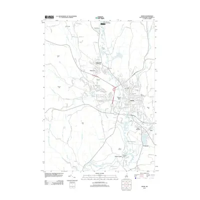
2012 Map of Keene
USGS Topo · Published 2012About this map
The Ashuelot River corridor anchors this 2012 study of Cheshire County, centering on the city of Keene. The urban core is well-defined by landmark institutions like Keene State College and extensive burial grounds including Woodland Cem and Greenlawn Cem. To the north, the Surry Mountain Flood Control Area and Surry Mountain Camping Area reflect a landscape managed for both recreation and flood mitigation, while the Dillant-Hopkins Airport and the rail-oriented site of Swanzey Station to the south illustrate the region's evolving transportation infrastructure.
Find a feature on this map
192 named features on this map. Tap any name to fly to it.
Don’t see what you’re looking for? This feature index may not catch every label — zoom into the map to look around manually.
Map Details
Editions of this 2012 Keene Map
This is the sole edition of this map. No revisions or reprints were ever made.
Other maps of this area

1898 · Monadnock
USGS Topo · 1:62,500

1898 · Keene
USGS Topo · 1:62,500

1927 · Bellows Falls
USGS Topo · 1:48,000

1930 · Lovewell Mountain
USGS Topo · 1:62,500

1930 · Bellows Falls
USGS Topo · 1:62,500

1932 · Keene
USGS Topo · 1:62,500
1935 · Keene
USGS Topo · 1:62,500

1936 · Monadnock
USGS Topo · 1:62,500

1942 · Keene
USGS Topo · 1:125,000

1942 · Lovewell Mountain
USGS Topo · 1:62,500