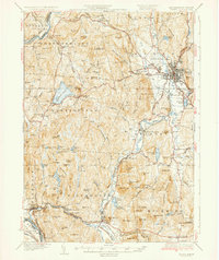
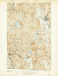
1935 Map of Keene
USGS Topo · Published 1935About this map
The Connecticut River forms the western boundary of this New Hampshire landscape, where the Boston and Maine RR winds through the industrial and agricultural valleys of the 1930s. The regional hub of Keene serves as a focal point, showing a dense grid of streets near the confluence of Beaver Brook and The Branch. To the west, the rugged topography of Pisgah Mountain is dotted with water bodies like Pisgah Reservoir and Kilburn Pond, while the shores of Spofford Lake are developed with Camp Namaschaug. Local industry and conservation efforts are evident through the Richmond Trout Rearing Station and numerous mill sites. Rural life is anchored by family-named landmarks such as Butterfield Hill and Stearns Hill, alongside institutional sites like the County Farm and the Hyland Hill Fire Tower, reflecting a decade of established infrastructure and resource management.
Find a feature on this map
118 named features on this map. Tap any name to fly to it.
Don’t see what you’re looking for? This feature index may not catch every label — zoom into the map to look around manually.
Map Details
Editions of this 1935 Keene Map
5 editions found
Other maps of this area

1887 · Warwick
USGS Topo · 1:62,500

1887 · Winchendon
USGS Topo · 1:62,500

1889 · Warwick
USGS Topo · 1:62,500

1890 · Greenfield
USGS Topo · 1:62,500

1890 · Winchendon
USGS Topo · 1:62,500

1891 · Brattleboro
USGS Topo · 1:62,500

1893 · Brattleboro
USGS Topo · 1:62,500

1894 · Winchendon
USGS Topo · 1:62,500

1894 · Greenfield
USGS Topo · 1:62,500

1894 · Warwick
USGS Topo · 1:62,500