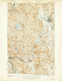
1935 Map of Keene
USGS Topo · Published 1946About this map
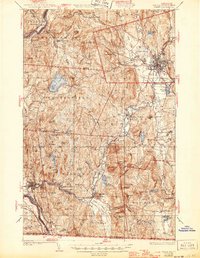
Keene sits at the heart of this Cheshire County landscape, where the Ashuelot River and its many tributaries, such as Beaver Bk and Ash Swamp Brook, shaped the industrial and agricultural development of the early 20th century. The terrain is defined by prominent peaks like Mt Pisgah and Bald Hill, interspersed with small rural settlements including Westmoreland, Richmond, and Hinsdale. Transportation is anchored by the Boston and Maine RR and the Dartmouth College Road, facilitating movement between the Connecticut River valley and the interior New Hampshire hills. Local history is preserved through numerous rural schoolhouses such as Superior Sch and Center Sch, while the presence of a Fire Tower on Hyland Hill reflects the era’s vital forest management. These details, alongside markers like Meetinghouse Hill and Mine Ledge, offer a clear picture of a New England region balancing its manufacturing hubs with deeply rooted rural communities.
Find a feature on this map
97 named features on this map. Tap any name to fly to it.
Don’t see what you’re looking for? This feature index may not catch every label — zoom into the map to look around manually.
Map Details
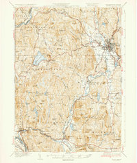
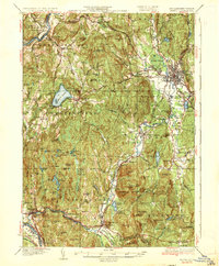
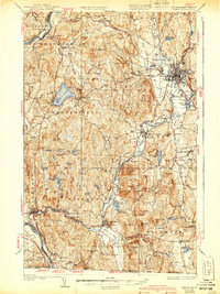
Editions of this 1935 Keene Map
5 editions found
Other maps of this area

1887 · Warwick
USGS Topo · 1:62,500

1887 · Winchendon
USGS Topo · 1:62,500

1889 · Warwick
USGS Topo · 1:62,500

1890 · Greenfield
USGS Topo · 1:62,500

1890 · Winchendon
USGS Topo · 1:62,500

1891 · Brattleboro
USGS Topo · 1:62,500

1893 · Brattleboro
USGS Topo · 1:62,500

1894 · Winchendon
USGS Topo · 1:62,500

1894 · Greenfield
USGS Topo · 1:62,500

1894 · Warwick
USGS Topo · 1:62,500