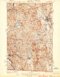
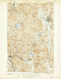
1935 Map of Keene
USGS Topo · Published 1946About this map
The Ashuelot River valley serves as the industrial and transit corridor for this part of Cheshire County, anchored by the dense street grid of Keene. During this era, the Boston and Maine RR and the Central Vermont RR define the movement of goods and people between settlements like West Swanzey and Hinsdale. Rural life is meticulously documented through family-named landmarks such as Butterfield Hill and Owls Hill, alongside essential community structures like the Superior Sch and Meetinghouse Hill.
Find a feature on this map
130 named features on this map. Tap any name to fly to it.
Don’t see what you’re looking for? This feature index may not catch every label — zoom into the map to look around manually.
Map Details
Editions of this 1935 Keene Map
5 editions found
Other maps of this area

1887 · Warwick
USGS Topo · 1:62,500

1887 · Winchendon
USGS Topo · 1:62,500

1889 · Warwick
USGS Topo · 1:62,500

1890 · Greenfield
USGS Topo · 1:62,500

1890 · Winchendon
USGS Topo · 1:62,500

1891 · Brattleboro
USGS Topo · 1:62,500

1893 · Brattleboro
USGS Topo · 1:62,500

1894 · Winchendon
USGS Topo · 1:62,500

1894 · Greenfield
USGS Topo · 1:62,500

1894 · Warwick
USGS Topo · 1:62,500