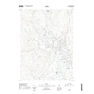
2018 Map of Keene
USGS Topo · Published 2018About this map
Keene sits at a geographic crossroads in southwestern New Hampshire, where the Ashuelot River and its various tributaries like Beaver Brook and Black Brook converge. This 2018 survey documents a landscape defined by its educational and industrial heritage, prominently featuring Keene State College and Antioch Univ New England within the urban core. The map traces the transition from the city center to outlying settlements such as North Swanzey and Swanzey Station, connected by a network of historic routes and the path of the Old B&M Railroad. Surrounding the valley, prominent heights like Beech Hill, Surry Mtn, and West Hill overlook the basin, while the Dillant-Hopkins Airport occupies the flatlands to the south. Local history is well-preserved through numerous burial grounds, including Woodland Cem and Saint Josephs Cem, alongside landmarks like the Sawyers Crossing Bridge.
Find a feature on this map
160 named features on this map. Tap any name to fly to it.
Don’t see what you’re looking for? This feature index may not catch every label — zoom into the map to look around manually.
Map Details
Editions of this 2018 Keene Map
This is the sole edition of this map. No revisions or reprints were ever made.
Other maps of this area

1898 · Monadnock
USGS Topo · 1:62,500

1898 · Keene
USGS Topo · 1:62,500

1927 · Bellows Falls
USGS Topo · 1:48,000

1930 · Lovewell Mountain
USGS Topo · 1:62,500

1930 · Bellows Falls
USGS Topo · 1:62,500

1932 · Keene
USGS Topo · 1:62,500
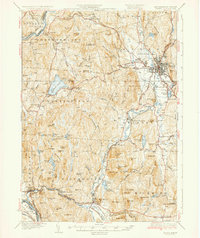
1935 · Keene
USGS Topo · 1:62,500

1936 · Monadnock
USGS Topo · 1:62,500

1942 · Keene
USGS Topo · 1:125,000

1942 · Lovewell Mountain
USGS Topo · 1:62,500