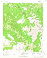
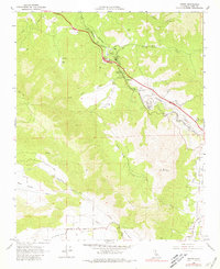
1966 Map of Keene
USGS Topo · Published 1967About this map
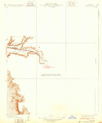
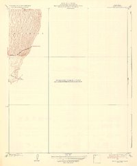
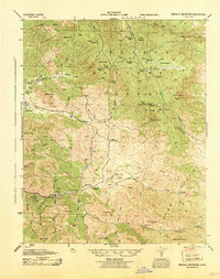
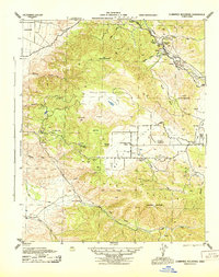
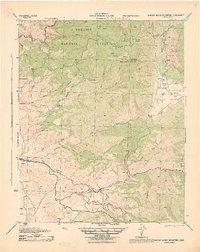
Southern Pacific tracks wind through the mountains of Kern County, following the natural course of Tehachapi Creek through a series of dramatic engineering feats. The most significant of these is The Loop at Walong, where the railway spirals over itself to manage the steep grade. This mid-1960s survey illustrates a landscape of high valleys and rugged peaks, including Black Mountain and the expansive Bear Valley to the south. Local life centers on small rail-aligned settlements like Keene, which features the Keene Sch and Keene PO. To the south, Cummings Valley and Brite Valley show a shift toward agricultural and ranching land, connected by the Bear Valley Road. Numerous water sources, such as Clear Creek and various Springs, are noted across the terrain, alongside infrastructure like a major Pipeline crossing the valleys.
Find a feature on this map
32 named features on this map. Tap any name to fly to it.
Don’t see what you’re looking for? This feature index may not catch every label — zoom into the map to look around manually.
Map Details
Editions of this 1966 Keene Map
2 editions found
Other maps of this area

1914 · Caliente
USGS Topo · 1:125,000

1915 · Mojave
USGS Topo · 1:125,000
1929 · Bena
USGS Topo · 1:31,680
1930 · Bear Mountain
USGS Topo · 1:31,680
1932 · Bena
USGS Topo · 1:31,680
1933 · Bear Mountain
USGS Topo · 1:31,680

1943 · Tehachapi
USGS Topo · 1:62,500
1943 · Emerald Mtn
USGS Topo · 1:62,500
1943 · Cummings Mountain
USGS Topo · 1:62,500
1943 · Breckenridge Mountain
USGS Topo · 1:62,500