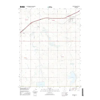
2016 Map of Keenesburg
USGS Topo · Published 2016About this map
Keenesburg and Hudson anchor this portion of the northern Colorado plains, where an intricate web of artificial waterways supports local agriculture. The landscape is defined by its massive water storage systems, including Prospect Reservoir and Horse Cr Reservoir, which are fed by a complex network of ditches like the Denver-Hudson Canal and Henrylyn Canal. These systems demonstrate the high-desert engineering required to sustain the communities of Roy and surrounding farmsteads. Local travel and transport are facilitated by a rigid grid of county roads and the major artery of Frontage Road I-76, while the Land Airport provides a distinct aviation landmark north of Ireland Reservoir Number Five. For genealogists and local historians, the map preserves the exact locations of numerous smaller reservoirs such as Lott Reservoir and the Banner Lakes complex, illustrating the vital connection between water rights and land use in Weld County.
Find a feature on this map
49 named features on this map. Tap any name to fly to it.
Don’t see what you’re looking for? This feature index may not catch every label — zoom into the map to look around manually.
Map Details
Editions of this 2016 Keenesburg Map
This is the sole edition of this map. No revisions or reprints were ever made.
Other maps of this area

1890 · East Denver
USGS Topo · 1:125,000

1902 · Greeley
USGS Topo · 1:125,000

1942 · Mile High Lakes
USGS Topo · 1:31,680

1949 · Sunnydale
USGS Topo · 1:24,000

1949 · Hudson
USGS Topo · 1:24,000

1950 · Tampa
USGS Topo · 1:24,000

1950 · Keenesburg
USGS Topo · 1:24,000

1950 · Prospect Valley
USGS Topo · 1:24,000

1950 · Klug Ranch
USGS Topo · 1:24,000
1950 · Milton Reservoir
USGS Topo · 1:24,000