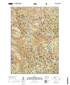
2020 Map of Keeney Point
USGS Topo · Published 2020About this map
Malheur National Forest dominates this high-altitude landscape in Grant County, defined by a complex network of canyons and perennial springs. The central prominent feature, Keeney Point, overlooks a series of drainages including Cyclone Canyon, Grouse Canyon, and Doe Canyon. These deep incisions into the plateau indicate a terrain shaped by heavy seasonal runoff, feeding into watercourses like Pass Cr and the S Fork Long Cr.
Find a feature on this map
34 named features on this map. Tap any name to fly to it.
Don’t see what you’re looking for? This feature index may not catch every label — zoom into the map to look around manually.
Map Details
Editions of this 2020 Keeney Point Map
This is the sole edition of this map. No revisions or reprints were ever made.
Other maps of this area

1949 · Long Creek
USGS Topo · 1:62,500

1949 · Susanville
USGS Topo · 1:62,500

1950 · Ritter
USGS Topo · 1:62,500

1951 · Susanville
USGS Topo · 1:62,500

1951 · Long Creek
USGS Topo · 1:62,500

1951 · Dale
USGS Topo · 1:62,500

1952 · Ritter
USGS Topo · 1:62,500

1955 · Canyon City
USGS Topo · 1:250,000

1959 · Canyon City
USGS Topo · 1:250,000

1980 · Monument
USGS Topo · 1:100,000