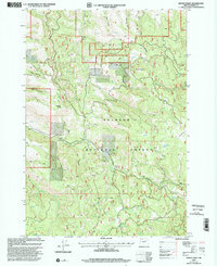
1999 Map of Keeney Point
USGS Topo · Published 2002About this map
Malheur National Forest dominates this high-country landscape, defined by a network of drainage canyons and prominent peaks. The western edge is carved by deep incisions such as Harer Canyon, War Canyon, and Cyclone Canyon, while the eastern side is anchored by Kahler Butte. The hydrology of the area is characterized by numerous seasonal and perennial sources, including Bear Wallow Spring, Twin Spring, and the headwaters of Long Creek. Evidence of land use is visible through the notation of Keeney Camp, various Corral sites, and isolated Mine and Quarry locations. A sophisticated network of 4wd tracks provides the primary access through the drainage divides and along Slide Ridge, illustrating the managed and utilized nature of this timbered and grazing terrain in the late 20th century.
Find a feature on this map
30 named features on this map. Tap any name to fly to it.
Don’t see what you’re looking for? This feature index may not catch every label — zoom into the map to look around manually.
Map Details
Editions of this 1999 Keeney Point Map
This is the sole edition of this map. No revisions or reprints were ever made.
Other maps of this area

1949 · Long Creek
USGS Topo · 1:62,500

1949 · Susanville
USGS Topo · 1:62,500

1950 · Ritter
USGS Topo · 1:62,500

1951 · Susanville
USGS Topo · 1:62,500

1951 · Long Creek
USGS Topo · 1:62,500

1951 · Dale
USGS Topo · 1:62,500

1952 · Ritter
USGS Topo · 1:62,500

1955 · Canyon City
USGS Topo · 1:250,000

1959 · Canyon City
USGS Topo · 1:250,000

1980 · Monument
USGS Topo · 1:100,000