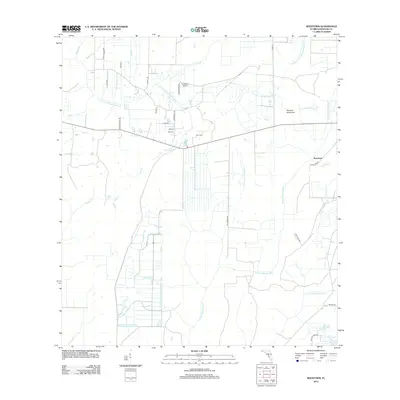
2012 Map of Keentown
USGS Topo · Published 2012About this map
Keentown sits at the nexus of the rural Manatee County landscape, where agriculture and hydrology define the geography. This 2012 survey documents a transition between established homesteads and modern aviation, highlighted by the presence of Southfork Airport and family legacies like the Keen Cem. The drainage pattern is particularly intricate, dominated by the S Fork Little Manatee River in the north and the converging systems of the N Fork Manatee River and E Fork Manatee River further south. Local transport relies on a network of named routes such as Taylor Grade Rd and Keentown Rd, while terrain features like Peacock Hammock and watercourses including Peacock Br and Keen Br reflect the deep family history etched into the Florida interior.
Find a feature on this map
30 named features on this map. Tap any name to fly to it.
Don’t see what you’re looking for? This feature index may not catch every label — zoom into the map to look around manually.
Map Details
Editions of this 2012 Keentown Map
This is the sole edition of this map. No revisions or reprints were ever made.
Other maps of this area

1944 · Rye
USGS Topo · 1:31,680

1944 · Wimauma
USGS Topo · 1:31,680

1944 · Verna
USGS Topo · 1:31,680

1947 · Wimauma
USGS Topo · 1:25,000

1956 · Myakka City NW
USGS Topo · 1:24,000

1956 · Ft Lonesome
USGS Topo · 1:24,000

1956 · Myakka Head
USGS Topo · 1:24,000

1956 · Duette NE
USGS Topo · 1:24,000
1956 · Wimauma
USGS Topo · 1:24,000

1956 · Duette
USGS Topo · 1:24,000