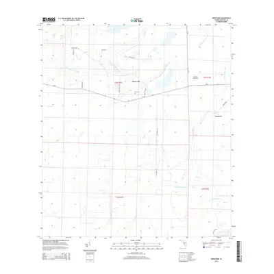
2015 Map of Keentown
USGS Topo · Published 2015About this map
Keentown and Bunker Hill anchor this rural landscape in Manatee County, defined by the winding tributaries of the S Fork Little Manatee River and N Fork Manatee River. The map highlights a network of creek systems including Moody Br, Baker Br, and Keen Br that feed into the larger river forks. Notable for local family history, the Keen Cem is situated near Bunker Hill Loop, while the presence of Nu-Gulf Mine Rd in the southeast corner indicates the reach of industrial phosphate mining activity into the agricultural area. The terrain transitions from the low-lying Peacock Hammock to more structured grid-like sections of citrus groves or pasture land, connected by rural corridors such as SR-62 and Bill Parrish Rd.
Find a feature on this map
30 named features on this map. Tap any name to fly to it.
Don’t see what you’re looking for? This feature index may not catch every label — zoom into the map to look around manually.
Map Details
Editions of this 2015 Keentown Map
This is the sole edition of this map. No revisions or reprints were ever made.
Other maps of this area

1944 · Rye
USGS Topo · 1:31,680

1944 · Wimauma
USGS Topo · 1:31,680

1944 · Verna
USGS Topo · 1:31,680

1947 · Wimauma
USGS Topo · 1:25,000

1956 · Myakka City NW
USGS Topo · 1:24,000

1956 · Ft Lonesome
USGS Topo · 1:24,000

1956 · Myakka Head
USGS Topo · 1:24,000

1956 · Duette NE
USGS Topo · 1:24,000
1956 · Wimauma
USGS Topo · 1:24,000

1956 · Duette
USGS Topo · 1:24,000