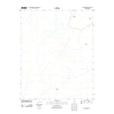
2011 Map of Keet Seel Canyon
USGS Topo · Published 2011About this map
Skeleton Mesa dominates the southern landscape of this Navajo County region, illustrating the complex drainage patterns and high-desert terrain characteristic of northern Arizona. The map highlights the significant elevation changes between the expansive Tyende Mesa and the lower Todicheenie Bench to the north. Waterways like Parrish Creek carve through the arid plateaus, while Azansosi Mesa stands as a prominent landmark on the eastern edge. This 2011 survey traces Indian Rte 6450 as it crosses the high northern plateau, providing a essential navigational reference for the network of mesas that define this portion of the Navajo Nation.
Find a feature on this map
6 named features on this map. Tap any name to fly to it.
Don’t see what you’re looking for? This feature index may not catch every label — zoom into the map to look around manually.
Map Details
Editions of this 2011 Keet Seel Canyon Map
This is the sole edition of this map. No revisions or reprints were ever made.
Other maps of this area

1883 · Marsh Pass
USGS Topo · 1:250,000

1892 · Marsh Pass
USGS Topo · 1:250,000

1952 · Shato Spring 1 NE
USGS Topo · 1:24,000

1952 · Agathla Peak 2 SW
USGS Topo · 1:24,000

1952 · Agathla Peak 2 NW
USGS Topo · 1:24,000

1952 · Boot Mesa
USGS Topo · 1:62,500

1952 · Agathla Peak 2 SE
USGS Topo · 1:24,000

1952 · Agathla Peak 2 NE
USGS Topo · 1:24,000

1956 · Marble Canyon
USGS Topo · 1:250,000

1959 · Marble Canyon
USGS Topo · 1:250,000