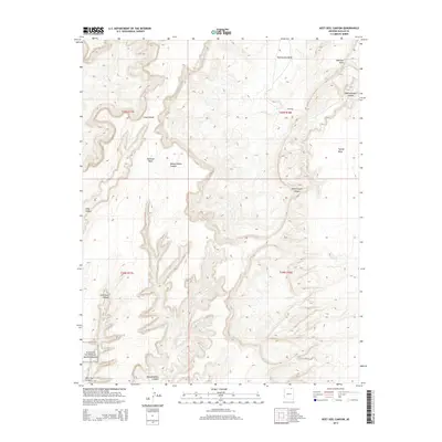
2014 Map of Keet Seel Canyon
USGS Topo · Published 2014About this map
Navajo National Monument occupies the southwestern corner of this landscape, an area defined by massive geological formations within the Navajo Nation. The terrain is dominated by high plateaus and deep incisions, including the expansive Skeleton Mesa and the winding Keet Seel Canyon. This environment features significant elevation changes from the Todicheenie Bench in the north to the canyon floors. The drainage pattern is complex, with Parrish Cr cutting through the center of the quadrangle while several prominent mesas, such as Azansosi Mesa and Tyende Mesa, stand as landmarks. The map illustrates the labyrinthine nature of the Dowozhiebito Canyon and Adahchijiyahi Canyon systems, reflecting a landscape where movement is dictated by the deep vertical relief of the sandstone canyons and high desert benches.
Find a feature on this map
14 named features on this map. Tap any name to fly to it.
Don’t see what you’re looking for? This feature index may not catch every label — zoom into the map to look around manually.
Map Details
Editions of this 2014 Keet Seel Canyon Map
This is the sole edition of this map. No revisions or reprints were ever made.
Other maps of this area

1883 · Marsh Pass
USGS Topo · 1:250,000

1892 · Marsh Pass
USGS Topo · 1:250,000

1952 · Shato Spring 1 NE
USGS Topo · 1:24,000

1952 · Agathla Peak 2 SW
USGS Topo · 1:24,000

1952 · Agathla Peak 2 NW
USGS Topo · 1:24,000

1952 · Boot Mesa
USGS Topo · 1:62,500

1952 · Agathla Peak 2 SE
USGS Topo · 1:24,000

1952 · Agathla Peak 2 NE
USGS Topo · 1:24,000

1956 · Marble Canyon
USGS Topo · 1:250,000

1959 · Marble Canyon
USGS Topo · 1:250,000