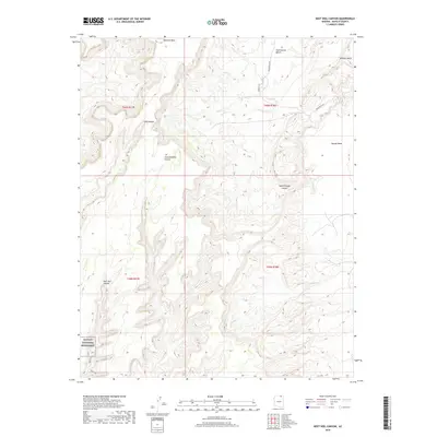
2018 Map of Keet Seel Canyon
USGS Topo · Published 2018About this map
Skeleton Mesa dominates the high desert plateau of this Navajo County landscape, where deep drainage systems have carved a complex network of sandstone corridors. The southwest corner of the quadrangle includes a portion of the Navajo National Monument, protecting significant cultural sites within the dramatic reach of Keet Seel Canyon. This area is defined by its topographic extremes, from the broad elevations of Todicheenie Bench and Tyende Mesa to the seasonal watercourses of Parrish Cr and Dowozhiebito Canyon. While Indian Rte 6450 provides limited vehicular access through the eastern sections, much of the terrain remains defined by its natural barriers, including the steep walls of Adahchijiyahi Canyon and Long Canyon. The map serves as a modern record of this protected high-altitude desert environment and its intricate geological features.
Find a feature on this map
16 named features on this map. Tap any name to fly to it.
Don’t see what you’re looking for? This feature index may not catch every label — zoom into the map to look around manually.
Map Details
Editions of this 2018 Keet Seel Canyon Map
This is the sole edition of this map. No revisions or reprints were ever made.
Other maps of this area

1883 · Marsh Pass
USGS Topo · 1:250,000

1892 · Marsh Pass
USGS Topo · 1:250,000

1952 · Shato Spring 1 NE
USGS Topo · 1:24,000

1952 · Agathla Peak 2 SW
USGS Topo · 1:24,000

1952 · Agathla Peak 2 NW
USGS Topo · 1:24,000

1952 · Boot Mesa
USGS Topo · 1:62,500

1952 · Agathla Peak 2 SE
USGS Topo · 1:24,000

1952 · Agathla Peak 2 NE
USGS Topo · 1:24,000

1956 · Marble Canyon
USGS Topo · 1:250,000

1959 · Marble Canyon
USGS Topo · 1:250,000