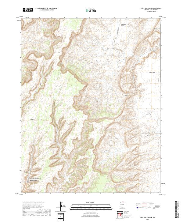
2021 Map of Keet Seel Canyon
USGS Topo · Published 2021About this map
Navajo National Monument anchors the southwestern corner of this landscape, protecting ancient cliff dwellings within the high desert terrain of the Navajo Nation. The topography is defined by the massive Skeleton Mesa, which separates the dramatic drainages of Long Canyon and Dowozhiebito Canyon. These deep incisions into the Colorado Plateau reveal the complex geological layering that characterizes the region. To the northeast, the terrain opens into broad high-altitude features like Azansosi Mesa and Tyende Mesa, where Indian Rte 6450 provides the primary access across the Todicheenie Bench. The seasonal flow of Parrish Cr and the eponymous Keet Seel Canyon illustrate the erosive power that has shaped this labyrinth of canyons and mesas over millennia, creating a sanctuary of natural and cultural significance.
Find a feature on this map
15 named features on this map. Tap any name to fly to it.
Don’t see what you’re looking for? This feature index may not catch every label — zoom into the map to look around manually.
Map Details
Editions of this 2021 Keet Seel Canyon Map
This is the sole edition of this map. No revisions or reprints were ever made.
Other maps of this area

1883 · Marsh Pass
USGS Topo · 1:250,000

1892 · Marsh Pass
USGS Topo · 1:250,000

1952 · Shato Spring 1 NE
USGS Topo · 1:24,000

1952 · Agathla Peak 2 SW
USGS Topo · 1:24,000

1952 · Agathla Peak 2 NW
USGS Topo · 1:24,000

1952 · Boot Mesa
USGS Topo · 1:62,500

1952 · Agathla Peak 2 SE
USGS Topo · 1:24,000

1952 · Agathla Peak 2 NE
USGS Topo · 1:24,000

1956 · Marble Canyon
USGS Topo · 1:250,000

1959 · Marble Canyon
USGS Topo · 1:250,000