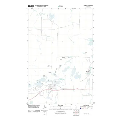
2010 Map of Keewatin
USGS Topo · Published 2010About this map
The industrial heart of Minnesota’s Iron Range is captured in this detail of the Mesabi Range, where the landscape is defined by extensive open-pit mining operations. The settlement of Keewatin serves as a central hub, flanked by a dense concentration of mineral excavations including the Bennett Mine, Stein Mine, and Mesabi Chief Mine. These sites illustrate the intensive earth-moving that transformed the local topography into a series of pits and ridges. To the east, the community of Kelly Lake remains connected by a network of local roads like 1st Ave N and the Old Highway 169 corridor.
Find a feature on this map
54 named features on this map. Tap any name to fly to it.
Don’t see what you’re looking for? This feature index may not catch every label — zoom into the map to look around manually.
Map Details
Editions of this 2010 Keewatin Map
This is the sole edition of this map. No revisions or reprints were ever made.
Other maps of this area

1951 · Hibbing
USGS Topo · 1:24,000

1952 · Keewatin
USGS Topo · 1:24,000

1952 · Riley
USGS Topo · 1:24,000

1952 · Nashwauk
USGS Topo · 1:24,000

1952 · Silica
USGS Topo · 1:24,000

1952 · Pengilly
USGS Topo · 1:24,000

1954 · Hibbing
USGS Topo · 1:250,000

1955 · Dewey Lake
USGS Topo · 1:24,000

1957 · Hibbing
USGS Topo · 1:250,000

1957 · Hibbing
USGS Topo · 1:24,000