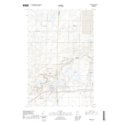
2019 Map of Keewatin
USGS Topo · Published 2019About this map
Keewatin and the western edge of Hibbing define this industrial landscape on the Mesabi Iron Range. The map reveals a complex terrain shaped by extensive open-pit mining, characterized by the dramatic contours around Stevenson and Bennett. These excavations sit in stark contrast to the natural hydrography of the region, including Welcome Lake, Libby Lake, and the Mahoning Lakes to the northeast.
Find a feature on this map
46 named features on this map. Tap any name to fly to it.
Don’t see what you’re looking for? This feature index may not catch every label — zoom into the map to look around manually.
Map Details
Editions of this 2019 Keewatin Map
This is the sole edition of this map. No revisions or reprints were ever made.
Other maps of this area

1951 · Hibbing
USGS Topo · 1:24,000

1952 · Keewatin
USGS Topo · 1:24,000

1952 · Riley
USGS Topo · 1:24,000

1952 · Nashwauk
USGS Topo · 1:24,000

1952 · Silica
USGS Topo · 1:24,000

1952 · Pengilly
USGS Topo · 1:24,000

1954 · Hibbing
USGS Topo · 1:250,000

1955 · Dewey Lake
USGS Topo · 1:24,000

1957 · Hibbing
USGS Topo · 1:250,000

1957 · Hibbing
USGS Topo · 1:24,000