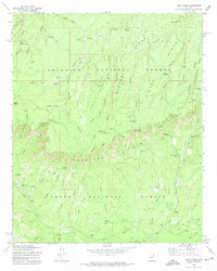
1972 Map of Kehl Ridge
USGS Topo · Published 1974About this map
The dramatic precipice of the Mogollon Rim serves as the dominant geographical divide in this 1970s survey, separating the high plateaus of the Coconino National Forest from the lower canyons of the Tonto National Forest. Settlement in this challenging landscape is sparse, marked by outposts such as General Springs Cabin and the small residential footprint of Washington Park. The area serves as a significant recreational and resource hub, evidenced by the presence of Camp Geronimo and Kehl Campground. Water management and natural springs are vital to the region, with the Verde River winding through the eastern portion of the sheet and numerous named water sources like Pieper Hatchery Spring and Lee Johnson Spring punctuating the ridges. High-altitude lakes like Potato Lake and a network of primitive routes including the Highline Trail (Pack) illustrate the land use patterns of central Arizona's rim country.
Find a feature on this map
71 named features on this map. Tap any name to fly to it.
Don’t see what you’re looking for? This feature index may not catch every label — zoom into the map to look around manually.
Map Details
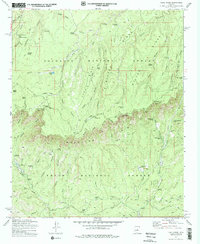
Editions of this 1972 Kehl Ridge Map
2 editions found
Other maps of this area

1887 · Verde
USGS Topo · 1:250,000

1892 · Verde
USGS Topo · 1:250,000

1934 · Pine
USGS Topo · 1:62,500

1934 · Promontory Butte
USGS Topo · 1:62,500

1939 · Promontory Butte
USGS Topo · 1:62,500

1940 · Pine
USGS Topo · 1:62,500

1952 · Pine
USGS Topo · 1:62,500

1952 · Promontory Butte
USGS Topo · 1:62,500

1954 · Holbrook
USGS Topo · 1:250,000

1957 · Holbrook
USGS Topo · 1:250,000
Featured Places
- Verde Glen, AZ
- Washington Park, AZ
- Rim Trail Mountain Club Estates, AZ
- Coconino County, AZ
- Gila County, AZ