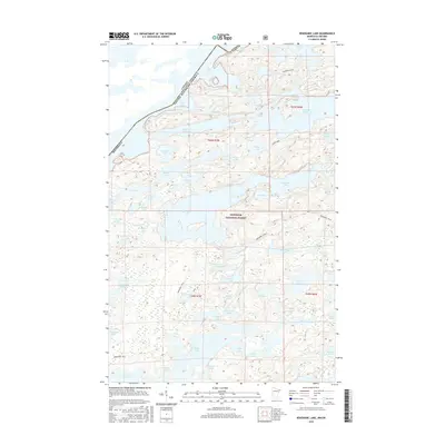
2016 Map of Kekekabic Lake
USGS Topo · Published 2016About this map
Kekekabic Trail cuts through the heart of the Superior National Forest in this 2016 survey, tracing a path through an incredibly dense network of glacial water bodies along the United States and Canada border. The northern boundary is defined by the expansive Knife Lake and its South Arm, where the international line zigzags across the water. This area is characterized by its lack of roads or permanent settlements, reflecting a landscape preserved in a primitive state for recreation and conservation.
Find a feature on this map
52 named features on this map. Tap any name to fly to it.
Don’t see what you’re looking for? This feature index may not catch every label — zoom into the map to look around manually.
Map Details
Editions of this 2016 Kekekabic Lake Map
This is the sole edition of this map. No revisions or reprints were ever made.
Other maps of this area

1954 · Two Harbors
USGS Topo · 1:250,000

1957 · Two Harbors
USGS Topo · 1:250,000

1957 · Ensign Lake
USGS Topo · 1:62,500

1957 · Quetico
USGS Topo · 1:250,000

1958 · Two Harbors
USGS Topo · 1:250,000

1959 · Ogishkemuncie Lake
USGS Topo · 1:24,000

1959 · Kekekabic Lake
USGS Topo · 1:24,000

1959 · Dutton Lake
USGS Topo · 1:24,000

1959 · Ester Lake
USGS Topo · 1:24,000

1960 · Lake Polly
USGS Topo · 1:24,000