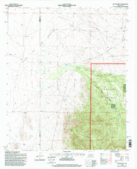
1995 Map of Kellog Well
USGS Topo · Published 1998About this map
Plains of San Agustin dominate the western horizon of this quadrangle, illustrating the transition from the broad alkaline basin of Catron County into the more complex topography of Socorro County. The arid landscape is defined by the critical infrastructure of range management, where isolated water sources like White Well, Old Sand Well, and Sexton Well supported ranching operations at the edge of the desert. The terrain shifts dramatically as it moves east into the Cibola National Forest, where the flat plains give way to the prominent Point Of Rocks and deep drainage systems such as Sargent Canyon and Kellog Canyon. This 1990s revision by the U.S. Forest Service identifies specific pastoral sites like Satahite Place, reflecting the continued importance of historical homesteads and range improvements including Kellog Tank and Sargent Tank in an area where water has always dictated the patterns of human activity.
Find a feature on this map
16 named features on this map. Tap any name to fly to it.
Don’t see what you’re looking for? This feature index may not catch every label — zoom into the map to look around manually.
Map Details
Editions of this 1995 Kellog Well Map
This is the sole edition of this map. No revisions or reprints were ever made.
Other maps of this area

1954 · Tularosa
USGS Topo · 1:250,000

1954 · Socorro
USGS Topo · 1:250,000

1958 · Socorro
USGS Topo · 1:250,000

1958 · Tularosa
USGS Topo · 1:250,000

1962 · Socorro
USGS Topo · 1:250,000

1963 · Anderson Peak
USGS Topo · 1:24,000

1964 · Arrowhead Well
USGS Topo · 1:24,000

1964 · Bay Buck Peaks
USGS Topo · 1:24,000

1964 · Monica Saddle
USGS Topo · 1:24,000

1965 · Oak Peak
USGS Topo · 1:24,000