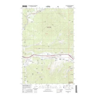
2017 Map of Kellogg West
USGS Topo · Published 2017About this map
The South Fork Coeur d'Alene River valley serves as the industrial and residential heart of this region, where the historic mining and smelting legacy of Northern Idaho is clearly visible. The landscape is defined by the concentrated line of settlements along the river, including Kellogg, Smelterville, and Bradley, which are hemmed in by the high ridges of the Coeur d'Alene National Forest. Further west, Pinehurst and Enaville mark the transition toward the North Fork Coeur d'Alene River. Detailed street names and mountain features like Haystack Peak and Graham Mtn provide essential context for researchers tracing the geography of the Silver Valley. The network of canyons, such as Government Gulch and Deadwood Gulch, highlights the intersection of steep mountain terrain and the infrastructure of the local mining economy.
Find a feature on this map
104 named features on this map. Tap any name to fly to it.
Don’t see what you’re looking for? This feature index may not catch every label — zoom into the map to look around manually.
Map Details
Editions of this 2017 Kellogg West Map
This is the sole edition of this map. No revisions or reprints were ever made.
Other maps of this area

1901 · Coeur D'Alene District
USGS Topo · 1:62,500

1903 · Coeur D'Alene District
USGS Topo · 1:62,500

1906 · Coeur D'Alene District
USGS Topo · 1:62,500

1909 · Cataldo
USGS Topo · 1:125,000

1911 · Cataldo
USGS Topo · 1:125,000

1950 · Twin Crags
USGS Topo · 1:24,000

1952 · Twin Crags
USGS Topo · 1:24,000

1955 · Spokane
USGS Topo · 1:250,000

1957 · Kingston
USGS Topo · 1:62,500

1957 · Kellogg
USGS Topo · 1:62,500