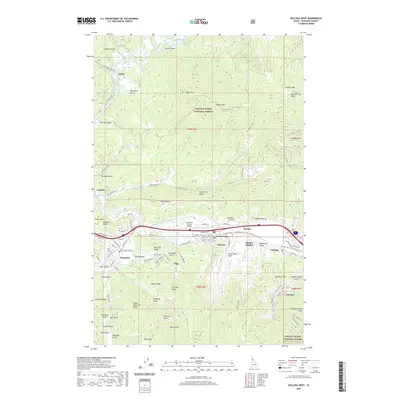
2020 Map of Kellogg West
USGS Topo · Published 2020About this map
Industrial history and mountain geography intersect at the western edge of the Silver Valley, where the South Fork Coeur d'Alene River corridor contains a dense string of mining-era settlements. Kellogg and Smelterville anchor the eastern side of the sheet, while the topography to the south is marked by the distinct legacy of lead and silver extraction in places like Smelter Heights, Government Gulch, and Deadwood Gulch. To the north, the North Fork Coeur d'Alene River winds through the Coeur d'Alene National Forest, passing the smaller communities of Enaville and Linfor. The transition from the valley floor, home to the Shoshone County Airport, to the high ridges of Graham Mtn and Fubar Peak illustrates the challenging terrain that shaped the development of this Idaho panhandle resource district.
Find a feature on this map
108 named features on this map. Tap any name to fly to it.
Don’t see what you’re looking for? This feature index may not catch every label — zoom into the map to look around manually.
Map Details
Editions of this 2020 Kellogg West Map
This is the sole edition of this map. No revisions or reprints were ever made.
Other maps of this area

1901 · Coeur D'Alene District
USGS Topo · 1:62,500

1903 · Coeur D'Alene District
USGS Topo · 1:62,500

1906 · Coeur D'Alene District
USGS Topo · 1:62,500

1909 · Cataldo
USGS Topo · 1:125,000

1911 · Cataldo
USGS Topo · 1:125,000

1950 · Twin Crags
USGS Topo · 1:24,000

1952 · Twin Crags
USGS Topo · 1:24,000

1955 · Spokane
USGS Topo · 1:250,000

1957 · Kingston
USGS Topo · 1:62,500

1957 · Kellogg
USGS Topo · 1:62,500