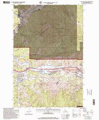
1996 Map of Kellogg West
USGS Topo · Published 1999About this map
Industrial operations and high-mountain recreation meet in this late-twentieth-century study of Idaho's Silver Valley. The legacy of the Coeur d'Alene mining district is clearly visible along the South Fork Coeur d'Alene River, where extensive tailings deposits, sewage disposal ponds, and settling ponds surround the major processing hubs of Smelterville and Bradley. The footprint of historic extraction is mapped in detail through family-named prospects and heavy industry, including the massive Bunker Hill Mine and the Last Chance Mine near Wardner.
Find a feature on this map
56 named features on this map. Tap any name to fly to it.
Don’t see what you’re looking for? This feature index may not catch every label — zoom into the map to look around manually.
Map Details
Editions of this 1996 Kellogg West Map
This is the sole edition of this map. No revisions or reprints were ever made.
Other maps of this area

1901 · Coeur D'Alene District
USGS Topo · 1:62,500

1903 · Coeur D'Alene District
USGS Topo · 1:62,500

1906 · Coeur D'Alene District
USGS Topo · 1:62,500

1909 · Cataldo
USGS Topo · 1:125,000

1911 · Cataldo
USGS Topo · 1:125,000

1950 · Twin Crags
USGS Topo · 1:24,000

1952 · Twin Crags
USGS Topo · 1:24,000

1955 · Spokane
USGS Topo · 1:250,000

1957 · Kingston
USGS Topo · 1:62,500

1957 · Kellogg
USGS Topo · 1:62,500