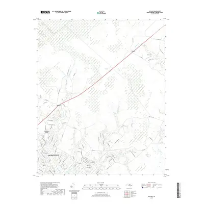
2019 Map of Kellum
USGS Topo · Published 2019About this map
Northeast Creek and its many tributaries, including Wolf Swamp and Little Northeast Creek, dominate the low-lying drainage patterns south of the White Oak Pocosin. This 2019 survey documents the suburban expansion of Jacksonville into the surrounding woodlands, showing a dense network of residential streets such as Piney Green Road and Country Club Drive pushing toward the rural outskirts. Smaller settlements like Kellum, Pumpkin Center, and Deppe maintain their identity along the primary transit corridors, while Epley Airport provides a localized aviation landmark north of the city. The landscape is a complex mix of riparian environments and newer development, with Morgan Bay and Horse Swamp highlighting the persistent wetlands that shape the local geography of Onslow County.
Find a feature on this map
89 named features on this map. Tap any name to fly to it.
Don’t see what you’re looking for? This feature index may not catch every label — zoom into the map to look around manually.
Map Details
Editions of this 2019 Kellum Map
This is the sole edition of this map. No revisions or reprints were ever made.
Other maps of this area

1942 · Maysville
USGS Topo · 1:62,500

1942 · Swansboro
USGS Topo · 1:62,500

1943 · Jacksonville
USGS Topo · 1:62,500

1948 · Maysville
USGS Topo · 1:62,500

1948 · Swansboro
USGS Topo · 1:62,500

1948 · New River
USGS Topo · 1:62,500

1952 · Hubert
USGS Topo · 1:24,000

1952 · Camp Lejeune
USGS Topo · 1:24,000

1952 · Jacksonville South
USGS Topo · 1:24,000

1953 · Beaufort
USGS Topo · 1:250,000