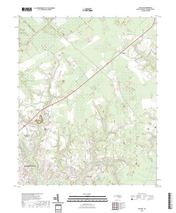
2022 Map of Kellum
USGS Topo · Published 2022About this map
Jacksonville and the outlying settlements of Pumpkin Center and Kellum anchor the southern reaches of this landscape, where residential development begins to meet the dense wetlands of Onslow County. The terrain is defined by an intricate network of waterways, including Wolf Swamp, Northeast Cr, and Little Northeast Cr, which drain toward the tidal waters of Morgan Bay. To the north, the environment shifts toward the expansive White Oak Pocosin, a distinct bogland ecosystem characterized by its scrubby vegetation and limited road access. Civil aviation is represented by Epley Airport near the community of Deppe, while the road network shows the progression of suburban growth through named residential streets like Chaparral Trl and Sparkling Brook Way. This 2022 survey captures the modern interface between the growing coastal plain communities and the persistent low-lying swamps of eastern North Carolina.
Find a feature on this map
92 named features on this map. Tap any name to fly to it.
Don’t see what you’re looking for? This feature index may not catch every label — zoom into the map to look around manually.
Map Details
Editions of this 2022 Kellum Map
This is the sole edition of this map. No revisions or reprints were ever made.
Other maps of this area

1942 · Maysville
USGS Topo · 1:62,500

1942 · Swansboro
USGS Topo · 1:62,500

1943 · Jacksonville
USGS Topo · 1:62,500

1948 · Maysville
USGS Topo · 1:62,500

1948 · Swansboro
USGS Topo · 1:62,500

1948 · New River
USGS Topo · 1:62,500

1952 · Hubert
USGS Topo · 1:24,000

1952 · Camp Lejeune
USGS Topo · 1:24,000

1952 · Jacksonville South
USGS Topo · 1:24,000

1953 · Beaufort
USGS Topo · 1:250,000