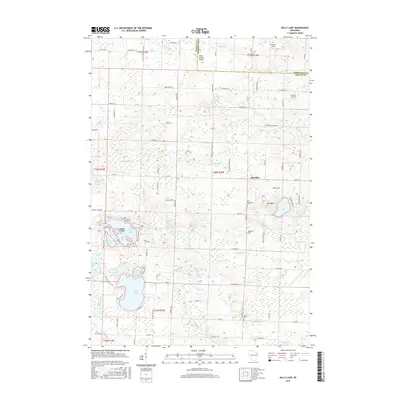
2015 Map of Kelly Lake
USGS Topo · Published 2015About this map
Kelly Lake and the surrounding Oconto County wetlands anchor this 2015 survey, revealing a landscape defined by an intricate network of glacial lakes and small-scale aviation. The settlement of Klondike serves as a local hub, situated near the rolling terrain of Mt LeBett. Family-named landmarks like Tachick Field, Buds Landing Airport, and Frievalt Airport highlight the importance of private airfields in this rural Wisconsin community. The map details a sophisticated water system where Leigh Flowage connects to Rice Bay and Marl Bay, while numerous smaller basins like Jocko Lake and Rost Lake dot the countryside. Cultural history is preserved at the Saint Wenceslaus Cem, Brazeau Cem, and Spruce Cem, providing vital geographic anchors for genealogists and local historians studying the township's long-established residents and the development of the roads like Old 64 RD.
Find a feature on this map
110 named features on this map. Tap any name to fly to it.
Don’t see what you’re looking for? This feature index may not catch every label — zoom into the map to look around manually.
Map Details
Editions of this 2015 Kelly Lake Map
This is the sole edition of this map. No revisions or reprints were ever made.
Other maps of this area

1941 · Coleman
USGS Topo · 1:48,000

1942 · Coleman
USGS Topo · 1:48,000

1942 · Breed
USGS Topo · 1:48,000

1950 · Coleman
USGS Topo · 1:48,000

1952 · Mountain
USGS Topo · 1:48,000

1954 · Iron Mountain
USGS Topo · 1:250,000

1955 · Green Bay
USGS Topo · 1:250,000

1956 · Gillett
USGS Topo · 1:62,500

1956 · Oconto Falls
USGS Topo · 1:62,500

1959 · Iron Mountain
USGS Topo · 1:250,000