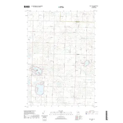
2018 Map of Kelly Lake
USGS Topo · Published 2018About this map
The boundary between Marinette Co and Oconto Co divides this rural Wisconsin landscape, defined by an intricate network of lakes and marshes. Kelly Lake stands out as a focal point in the south, while the complex waters of Leigh Flowage, including Rice Bay, Marl Bay, and Green Island, dominate the western half of the sheet. The settlement at Klondike serves as a local hub, surrounded by family-named infrastructure such as Brazeau Town Hall Ln and Section 8 Church Rd.
Find a feature on this map
93 named features on this map. Tap any name to fly to it.
Don’t see what you’re looking for? This feature index may not catch every label — zoom into the map to look around manually.
Map Details
Editions of this 2018 Kelly Lake Map
This is the sole edition of this map. No revisions or reprints were ever made.
Other maps of this area

1941 · Coleman
USGS Topo · 1:48,000

1942 · Coleman
USGS Topo · 1:48,000

1942 · Breed
USGS Topo · 1:48,000

1950 · Coleman
USGS Topo · 1:48,000

1952 · Mountain
USGS Topo · 1:48,000

1954 · Iron Mountain
USGS Topo · 1:250,000

1955 · Green Bay
USGS Topo · 1:250,000

1956 · Gillett
USGS Topo · 1:62,500

1956 · Oconto Falls
USGS Topo · 1:62,500

1959 · Iron Mountain
USGS Topo · 1:250,000