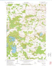
1973 Map of Kelly Lake
USGS Topo · Published 1977About this map
Kelly Lake and the surrounding Oconto County wetlands dominate this 1970s landscape, characterized by a complex network of glacial lakes and creek systems. Small rural hubs such as Klondike and the scattered residences near Patz are connected by a grid of local routes like Goldfield Road and Twenty Road. This era shows a community structured around both its natural water resources and its local institutions, with several legacy sites such as Section Eight Church and the Brazeau Cem serving the township.
Find a feature on this map
57 named features on this map. Tap any name to fly to it.
Don’t see what you’re looking for? This feature index may not catch every label — zoom into the map to look around manually.
Map Details
Editions of this 1973 Kelly Lake Map
This is the sole edition of this map. No revisions or reprints were ever made.
Other maps of this area

1941 · Coleman
USGS Topo · 1:48,000

1942 · Coleman
USGS Topo · 1:48,000

1942 · Breed
USGS Topo · 1:48,000

1950 · Coleman
USGS Topo · 1:48,000

1952 · Mountain
USGS Topo · 1:48,000

1954 · Iron Mountain
USGS Topo · 1:250,000

1955 · Green Bay
USGS Topo · 1:250,000

1956 · Gillett
USGS Topo · 1:62,500

1956 · Oconto Falls
USGS Topo · 1:62,500

1959 · Iron Mountain
USGS Topo · 1:250,000