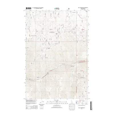
2013 Map of Kelly Mountain
USGS Topo · Published 2013About this map
Salmon River canyons dominate this central Idaho landscape, where the boundary between the Nez Perce National Forest and Payette National Forest follows the winding river's course. Early twenty-first-century topography reveals a sparsely populated backcountry centered around French Creek and the Howard Ranch. Notable for its difficult terrain, the area is marked by distinctive landmarks like The Crevice and Manning Bridge, which serves as a rare crossing point near Chamberlain Gulch. The northern portion of the map covers the historic Florence Basin, a region synonymous with Idaho's nineteenth-century gold rush history. From the heights of Kelly Mtn and Looking Glass Butte to the lower reaches of Flock Canyon, the map provides an intricate look at the drainage systems of Little Slate Cr and Kelly Cr that define this high-elevation wilderness.
Find a feature on this map
43 named features on this map. Tap any name to fly to it.
Don’t see what you’re looking for? This feature index may not catch every label — zoom into the map to look around manually.
Map Details
Editions of this 2013 Kelly Mountain Map
This is the sole edition of this map. No revisions or reprints were ever made.
Other maps of this area

1931 · Buffalo Hump
USGS Topo · 1:125,000

1934 · Buffalo Hump
USGS Topo · 1:125,000

1938 · Riggins
USGS Topo · 1:96,000

1945 · Riggins
USGS Topo · 1:125,000

1955 · Grangeville
USGS Topo · 1:250,000

1956 · Burgdorf
USGS Topo · 1:62,500

1956 · Elk City
USGS Topo · 1:250,000

1959 · Grangeville
USGS Topo · 1:250,000

1960 · Elk City
USGS Topo · 1:250,000

1963 · John Day Mtn
USGS Topo · 1:24,000