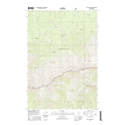
2017 Map of Kelly Mountain
USGS Topo · Published 2017About this map
The Salmon River cuts a deep, dramatic path across this part of Idaho County, serving as the primary geographic divider between the Nez Perce National Forest to the north and the Payette National Forest to the south. Along its banks, the Manning Bridge provides a critical crossing point near the mouth of Chamberlain Gulch, while the small settlement of French Creek sits at a narrow junction where the river meets its namesake tributary. The landscape is defined by significant elevation changes, rising from the riverbed to prominent heights such as Kelly Mountain and the curiously named Looking Glass Butte. Evidence of the region's mining and grazing history can be seen in place names like Florence Basin and Cow Flats, while the remote character of the area is underscored by the network of Forest Service routes, including the Florence Rd and the Big Salmon Rd.
Find a feature on this map
39 named features on this map. Tap any name to fly to it.
Don’t see what you’re looking for? This feature index may not catch every label — zoom into the map to look around manually.
Map Details
Editions of this 2017 Kelly Mountain Map
This is the sole edition of this map. No revisions or reprints were ever made.
Other maps of this area

1931 · Buffalo Hump
USGS Topo · 1:125,000

1934 · Buffalo Hump
USGS Topo · 1:125,000

1938 · Riggins
USGS Topo · 1:96,000

1945 · Riggins
USGS Topo · 1:125,000

1955 · Grangeville
USGS Topo · 1:250,000

1956 · Burgdorf
USGS Topo · 1:62,500

1956 · Elk City
USGS Topo · 1:250,000

1959 · Grangeville
USGS Topo · 1:250,000

1960 · Elk City
USGS Topo · 1:250,000

1963 · John Day Mtn
USGS Topo · 1:24,000