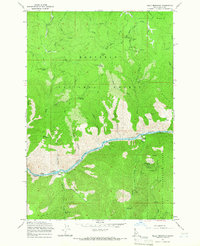
1964 Map of Kelly Mountain
USGS Topo · Published 1966About this map
The Salmon River cuts a deep corridor through this mid-1960s survey of Idaho County, dividing the Nez Perce National Forest to the north from the Payette National Forest to the south. The northern portion of the map is dominated by the Florence Basin, a historic gold-producing region. A dense concentration of mining claims is visible here, including the Mother Lode Mine, Poorman Mine, Lone Pine Mine, and Black Bear Mine. These sites speak to the era's continued interest in the mineral wealth of the high country, where peaks like Kelly Mountain and Looking Glass Butte rise above the drainage networks.
Find a feature on this map
53 named features on this map. Tap any name to fly to it.
Don’t see what you’re looking for? This feature index may not catch every label — zoom into the map to look around manually.
Map Details
Editions of this 1964 Kelly Mountain Map
This is the sole edition of this map. No revisions or reprints were ever made.
Other maps of this area

1931 · Buffalo Hump
USGS Topo · 1:125,000

1934 · Buffalo Hump
USGS Topo · 1:125,000

1938 · Riggins
USGS Topo · 1:96,000

1945 · Riggins
USGS Topo · 1:125,000

1955 · Grangeville
USGS Topo · 1:250,000

1956 · Burgdorf
USGS Topo · 1:62,500

1956 · Elk City
USGS Topo · 1:250,000

1959 · Grangeville
USGS Topo · 1:250,000

1960 · Elk City
USGS Topo · 1:250,000

1963 · John Day Mtn
USGS Topo · 1:24,000