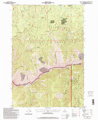
1995 Map of Kelly Mountain
USGS Topo · Published 1999About this map
The gold-bearing basin of Florence sits atop a high plateau in the southern reaches of the Nez Perce National Forest, where 1990s mining activity and historical claim boundaries illustrate a long legacy of resource extraction. The landscape is defined by the deep carving of the Salmon River, which marks the boundary between the Nez Perce and the Payette National Forest. Along the riverbanks, the map identifies The Crevice and the Manning Bridge, vital crossing points in a terrain of steep canyons and high saddles like Coffee Can Saddle.
Find a feature on this map
54 named features on this map. Tap any name to fly to it.
Don’t see what you’re looking for? This feature index may not catch every label — zoom into the map to look around manually.
Map Details
Editions of this 1995 Kelly Mountain Map
This is the sole edition of this map. No revisions or reprints were ever made.
Other maps of this area

1931 · Buffalo Hump
USGS Topo · 1:125,000

1934 · Buffalo Hump
USGS Topo · 1:125,000

1938 · Riggins
USGS Topo · 1:96,000

1945 · Riggins
USGS Topo · 1:125,000

1955 · Grangeville
USGS Topo · 1:250,000

1956 · Burgdorf
USGS Topo · 1:62,500

1956 · Elk City
USGS Topo · 1:250,000

1959 · Grangeville
USGS Topo · 1:250,000

1960 · Elk City
USGS Topo · 1:250,000

1963 · John Day Mtn
USGS Topo · 1:24,000