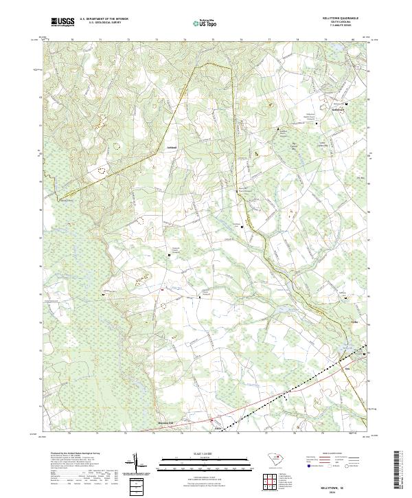
2024 Map of Kellytown
USGS Topo · Published 2024About this map
Lynches River carves the western boundary of this landscape, where the flatlands of the South Carolina coastal plain meet a dense network of blackwater drainages. The area is defined by its numerous "bays" and swamps, including Big Cypress Bay, Little Cypress Bay, and the winding Sparrow Swamp. These wetlands dictate the placement of local settlements, with Ashland and Kellytown situated on higher ground above the floodplains.
Find a feature on this map
131 named features on this map. Tap any name to fly to it.
Don’t see what you’re looking for? This feature index may not catch every label — zoom into the map to look around manually.
Map Details
Editions of this 2024 Kellytown Map
This is the sole edition of this map. No revisions or reprints were ever made.
Other maps of this area

1941 · Spartanburg
USGS Topo · 1:250,000

1953 · Spartanburg
USGS Topo · 1:250,000

1957 · Ashwood
USGS Topo · 1:62,500

1960 · Spartanburg
USGS Topo · 1:250,000

1963 · Spartanburg
USGS Topo · 1:250,000

1964 · Spartanburg
USGS Topo · 1:250,000
1968 · Hartsville North
USGS Topo · 1:24,000
1968 · Lake Robinson
USGS Topo · 1:24,000

1968 · Kellytown
USGS Topo · 1:24,000
1968 · Hartsville South
USGS Topo · 1:24,000